The almost $1.5 billion in federal crop insurance indemnities sent to farmers in the Mississippi River Critical Conservation Area for flooding damage between 2001 and 2020 could have instead taken more than 300,000 acres of frequently flooded farmland out of production.
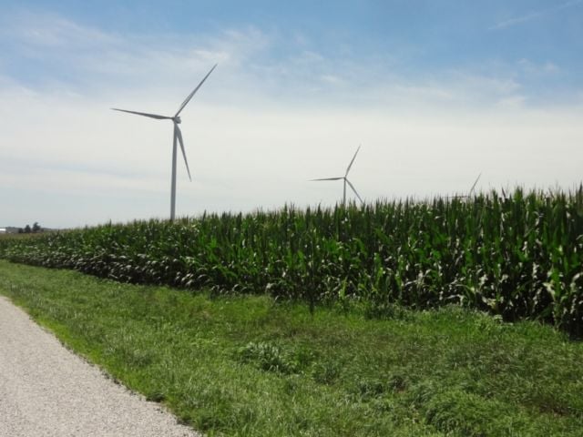
Putting this much marginal land – an area half the size of Rhode Island – into permanent conservation easements in the 13-state Mississippi River Critical Conservation Area, or MRCCA, would have multiple benefits for the environment, climate mitigation and public health, and would be a better use of taxpayer dollars. Many parts of the MRCCA experience frequent flooding that is getting worse, thanks to the climate crisis.
Those are the latest findings of EWG’s ongoing research into the Federal Crop Insurance Program’s spending. Earlier investigations found that the climate crisis has likely contributed to billions of dollars in crop insurance payouts since 1995 and that MRCCA counties received over $51.5 billion in total crop insurance indemnities between 2001 and 2020. The Crop Insurance Program is managed by the Department of Agriculture’s Risk Management Agency.
Farmer demand for land retirement exceeds available funding
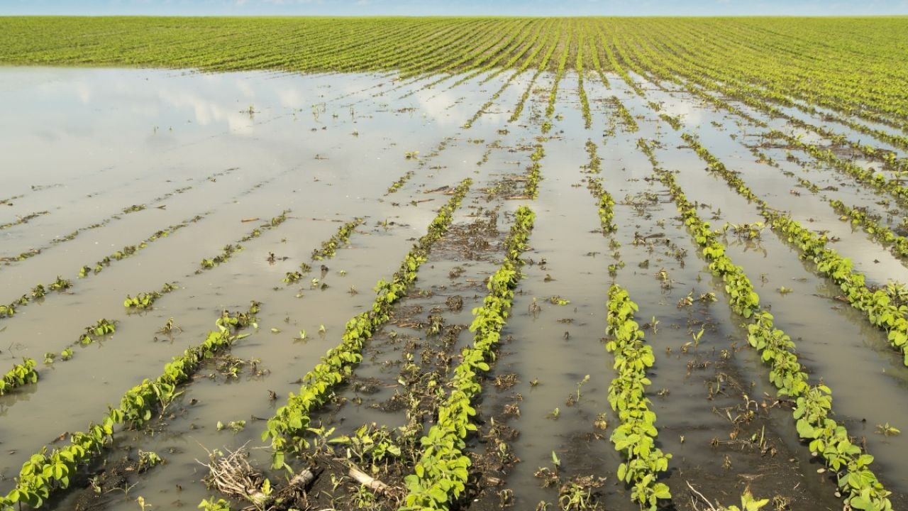
Flooding is a major issue in the MRCCA, and the climate crisis is expected to increase the frequency and severity of flooding in this region, likely raising the cost and frequency of flood crop insurance payments. But as EWG has pointed out, crop insurance does not encourage or require farmers to adapt to climate change.
In fact, crop insurance may be discouraging climate change adaptation by subsidizing farmers who farm on frequently flooded lands, because they know some losses will be covered by the program and because they do not pay the full cost of their crop insurance premiums. Taxpayers subsidize, on average, 60 percent.
Through multiple programs, including its Agricultural Conservation Easement Program, the USDA spends money each year to retire and restore frequently flooded, environmentally sensitive land. But the agency turns away nine out of 10 producers who apply to enroll in the wetlands portion of this program.
The Crop Insurance Program should be reformed so that premium subsidies in high-risk areas like frequently flooded fields are reduced. Additionally, more funding should go to conservation programs that pay to take these fields out of production permanently. These reforms would not only be beneficial for the climate, the environment and public health, but also for farmers and communities in the MRCCA.
Flooding payments in the MRCCA are widespread and frequent
Crop insurance payments are disproportionately large in the MRCCA, totaling over $51.5 billion dollars between 2001 and 2020. Flooding was the fifth largest cause of loss during this period in the region, and the third largest among weather-related losses, after excess moisture and drought.
Just over 1,000 counties in the region received crop insurance indemnities from any cause of loss in the 20 years, and 86 percent got payments for flooding. Flood crop insurance payments are frequent – 41 percent of counties that received flood payments got one in at least half of the years. Table 1 has the breakdown of flood crop insurance payments by state in the MRCCA.
Table 1. Almost $1.5 billion in flood crop insurance indemnities went to the MRCCA from 2001 through 2020.
| MRCCA state | Flood crop insurance payments |
| Missouri | $411,070,950 |
| Iowa | $242,945,182 |
| Illinois | $161,485,337 |
| Indiana | $135,679,368 |
| Mississippi | $110,994,884 |
| Arkansas | $88,763,575 |
| Kentucky | $87,094,360 |
| Tennessee | $58,146,382 |
| Louisiana | $56,466,774 |
| South Dakota | $42,823,419 |
| Wisconsin | $17,294,283 |
| Ohio | $8,874,314 |
| Minnesota | $7,875,806 |
| Total | $1,429,514,635 |
Source: EWG, from the USDA’s Risk Management Agency, Cause of Loss Historical Data Files
‘Hot spot’ counties
Within the MRCCA, there were 41 counties that each received over $8 million in flood crop insurance indemnities between 2001 and 2020. These are the hot spot counties with the most flood outlays, shown on EWG’s MRCCA Crop Insurance Hot Spot Map as the two dark purple colors on the flood layer.
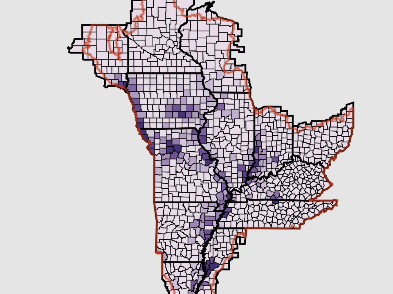
The map highlights total flood crop insurance payouts, called indemnities, as well as payouts from the top five weather-related causes of loss in the Mississippi River Critical Conservation Area.
Together, these 41 counties received over $635.8 million in flood indemnities, which represents 44 percent of total flood crop insurance payments in the region. Missouri had by far the most hot spot flood counties, as well as flood indemnities (Table 2).
Table 2. The 41 flood crop insurance hot spot counties were located in 10 states.
| MRCCA state | Count of hot spot counties | Flood indemnities | Percent of hot spot flood payments |
| Missouri | 13 | $260,093,609 | 41% |
| Mississippi | 5 | $90,883,807 | 14% |
| Iowa | 5 | $83,176,471 | 13% |
| Illinois | 4 | $43,763,234 | 7% |
| Indiana | 3 | $38,973,541 | 6% |
| Tennessee | 3 | $38,880,928 | 6% |
| South Dakota | 2 | $28,205,505 | 4% |
| Louisiana | 2 | $19,108,742 | 3% |
| Arkansas | 2 | $16,628,002 | 3% |
| Kentucky | 2 | $16,103,055 | 3% |
Source: EWG, from the USDA’s Risk Management Agency, Cause of Loss Historical Data Files
Payments in the hot spot counties were also frequent. Of the 41 counties, 76 percent received flood crop insurance indemnities in at least 15 of the 20 years, whereas 49 percent got flood payments above the MRCCA county-level average in at least half of the years.
Crop insurance costs compared to permanent easements
Taxpayer funding that currently goes toward flood crop insurance indemnities could be better spent retiring farmland that is frequently flooded and expensive to insure. Permanent easements prevent designated farmland from being used for crop production, allowing it to be restored to its natural state.
There are significant benefits to retiring and restoring cropland permanently.
Retiring farmland in frequently flooded areas could reduce agriculture’s greenhouse gas emissions and soil erosion, and decrease the amount of agricultural pollution that ends up in drinking water and recreational waters. Environmentally sensitive farmland is also commonly marginal, which means crop yields are low and farmers often barely turn a profit on the land anyway.
Many different programs pay farmers to permanently retire farmland that frequently floods. Three of the main programs are the Emergency Watershed Protection – Floodplain Easement Program, the Agricultural Conservation Easement Program, or ACEP, and the Conservation Reserve Enhancement Program.
Taxpayers could fund hundreds of thousands more acres of permanent easements on frequently flooded cropland if these programs had more funding. Given the average dollar per acre cost of ACEP easements between 2014 and 2020, the $1,429,514,635 in MRCCA-wide flood insurance indemnities could have retired 331,784 acres in the region at the average ACEP cost.
At the 13-state average minimum ACEP cost between 2014 and 2020, 452,432 acres could have been retired, and 149,878 acres could have been retired for the almost $1.5 billion at the average maximum ACEP cost. See the methodology at the end of this report for more information.
In the 41 hot spot counties, the USDA could have permanently retired 130,259 acres of frequently flooded cropland for the $635.8 million spent on flood crop insurance indemnities between 2001 and 2020, at the average ACEP costs. At the lowest ACEP easement costs per acre in that time, 224,257 acres in the flood crop insurance hot spot counties could have been retired. Even at the highest costs per acre, 74,756 acres of permanent easements could have been established in these counties (Table 3).
Table 3. Many acres in the hot spot counties could have been retired, given the cost of ACEP easements and the flooding crop insurance indemnities that were paid out.
| States with the 41 hot spot flood counties | Potentially retired acres at 2014-2020 average price | Potentially retired acres at low price | Potentially retired acres at high price |
| Missouri | 51,486 | 98,336 | 29,683 |
| Mississippi | 23,622 | 38,340 | 10,363 |
| Iowa | 11,935 | 18,582 | 9,110 |
| Illinois | 9,321 | 19,600 | 3,293 |
| Indiana | 6,681 | 8,196 | 3,781 |
| Tennessee | 7,376 | 8,971 | 6,632 |
| South Dakota | 6,020 | 12,542 | 3,296 |
| Louisiana | 6,359 | 10,331 | 4,013 |
| Arkansas | 3,885 | 4,798 | 2,172 |
| Kentucky | 3,575 | 4,561 | 2,414 |
| Total | 130,259 | 224,257 | 74,756 |
Source: EWG, from USDA Risk Management Agency, Cause of Loss Historical Data Files
Recommendations for reform
Funding for federal conservation programs that establish permanent easements should be increased so more cropland with repeat flood crop insurance losses can be retired and restored.
Current funding for permanent and long-term easements is much smaller than payments for the crop insurance program and farm subsidy programs. In 2019 alone, national funding for the three easement programs described here was only $800.7 million, even including Agricultural Land Easements that allow cropland to continue being farmed. U.S. crop insurance indemnities across all causes of loss were $10.6 billion.
There are always more farmers who want to participate in the easement programs than funding can cover. In fiscal year 2019, farmers applied to retire more than 408,000 acres through ACEP’s wetland reserve easements, but only 9 percent of all applications were enrolled.
Reform to the crop insurance program itself could help address repeat flood losses. Reducing premium subsidies in high-risk areas like flood plains would give farmers a better idea how much risk they are actually taking on, discouraging them from growing in risky areas vulnerable to extreme weather caused by the climate crisis. Fewer premium subsidies in high-risk areas would mean taxpayers would also encourage less production of crops in environmentally sensitive areas, and reduce taxpayer spending.